
You’re offline. This is a read only version of the page.


When conducting a GPS-aided survey, be sure to first configure AirMagnet Survey's GPS COM port so that it can communicate with your GPS device. You can use any NMEA compliant GPS device with Survey. To see a list of GPS devices that have been tested by us for use with Survey, please click here and scroll to/expand the System Requirements section.
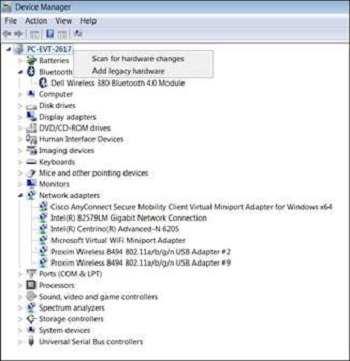
1. Within the Windows Device Manager, select the computer name. Right-click and select Add Legacy Hardware:
2. Ensure that Ports (COM & LPT) appear; if they do not, please work with your IT Department to troubleshoot:

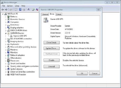
3. Ensure GPS drivers are properly installed and working on your GPS device; you may need to visit your GPS manufacturer's website to obtain the drivers:
4. Download the GpsGate Splitter from GPSGate's website at http://gpsgate.com/purchase/gpsgate_client_licenses; be sure to download the correct product, which is GpsGate Splitter Express (the free version)
5. With the GPS unit attached to your device, install the GpsGate Splitter Express
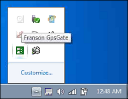
6. Once installed, hover over the task bar by the clock and select the green Franson GpsGate icon to open the configuration window:
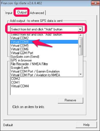
7. On the Franson GpsGate configuration window, choose the Output tab, click on Add then select a Virtual COM port. In this example, Virtual COM4 is used:
8. Launch AirMagnet Survey.
9. Open or create a GPS project.
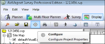
10. Go to the Survey or Display tab and click the Configuration button:
11. On the main Settings tab, click the lower button labeled 'Configure GPS'. This button will be greyed out if your project was not created as a GPS Survey.
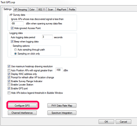
12. Configure the following:
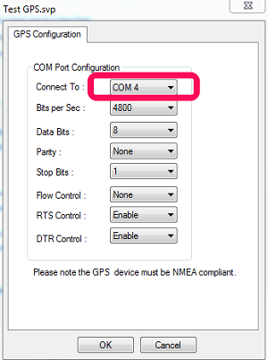
13. Click OK twice to exit this screen.
14. Go outside of any building you may be in with your device running Survey,
15. Click the Survey tab and start a Survey.
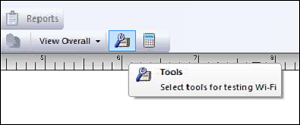
16. Click the Tools icon:
17. Select the GPS Information tab at the foot of the Tools window:
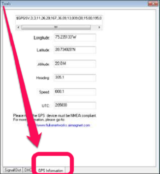
If everything is properly configured and you are outside of any building, Latitude and Longitude data should appear in their respective windows. That means you are successfully using GPS data from your GPS device within AirMagnet Survey.
If Latitude and Longitude data do not populate this screen, double-check that your GpsGate Virtual COM port matches your Survey GPS Configuration and that you are outside of any building.