
You’re offline. This is a read only version of the page.


Please note this feature is only available on the following devices and versions:
EtherScope nXG version 1.2: To update your unit please see: EtherScope nXG: Updating Software
AirCheck G2 version 5.0: To update your unit please see: AirCheck G2: Updating Firmware
AirCheck G3 Pro, to learn more please see: https://www.netally.com/products/aircheckg3/
The AirMapper* Site Survey application enables you to perform a Wi-Fi survey of an indoor or outdoor location and upload it to Link-Live. From here, you can view heatmaps and Wi-Fi measurements for each data collection point. The Signal heatmap is available to all users, however, some features are only available to units with a valid AllyCare support contract.
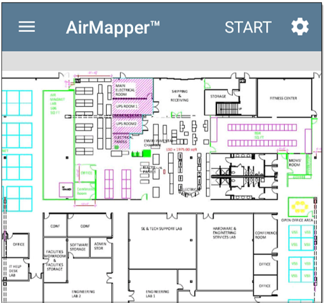
Once you've configured AirMapper with your floor image, it will appear on the main AirMapper screen.
Touch START to begin the survey. To collect data, travel around your site, and touch the map at your current location to scan the enabled wireless channels in that spot. Do not move from that location until the scan is complete and the data point on the screen turns from red to green.
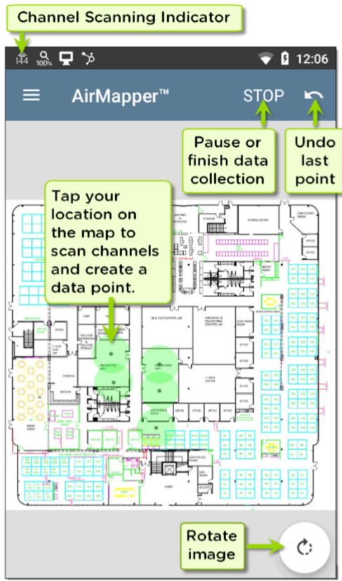
As shown in the image above, you can undo previous collection points and rotate the image as needed. Use swiping and pinch-to-zoom gestures to pan and zoom the map. While the EtherScope is scanning, the Signal Propagation circle is red. Once the scan is complete, the circle turns green.
Uploading AirMapper Surveys to Link-Live
When you touch the Link-Live upload (cloud) icon , the Link-Live sharing screen appears.
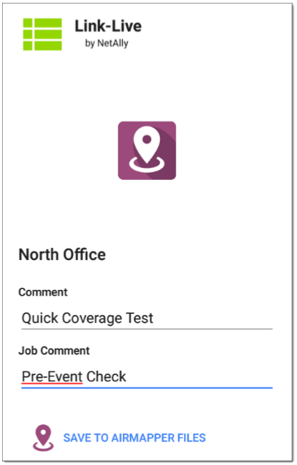
Enter any Comments you want attached to your AirMapper result in Link-Live, and tap SAVE TO AIRMAPPER FILES. The current survey remains on the AirMapper screen until you begin a New Survey, allowing you to add additional points if needed and reupload.
It is considered best practice to save your AirMapper walk every 5 to 10 minutes.
See EtherScope nXG/AirCheck G2: AirMapper Heat Maps to learn how to access the AirMapper Survey heat map.